Northern Illinois 2004
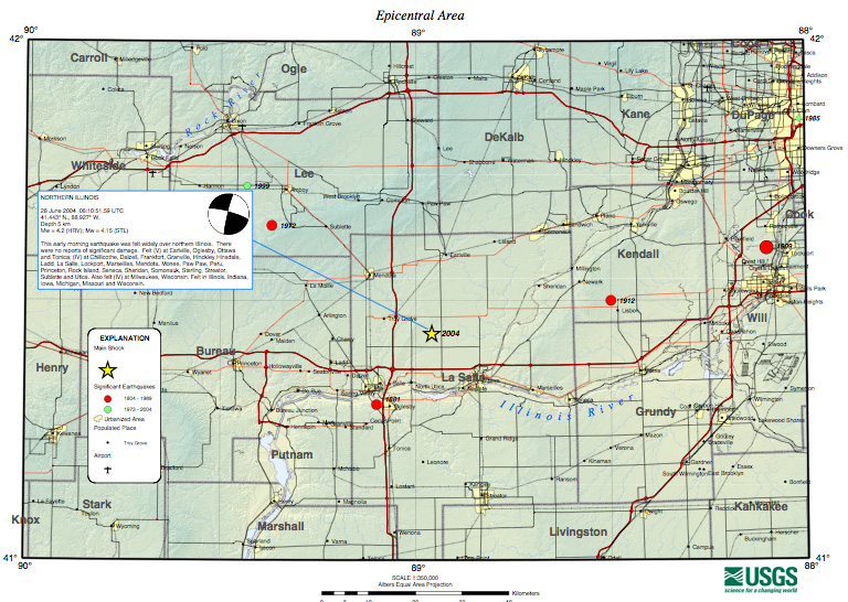
The seismic response team at CERI was sent to northern Illinois after the June 28 2004 earthquake. The Mw 4.2 earthquake occurred at 06:10:52.
location - latitude 41.46ºN, longitude 88.90ºW
depth 10.0 km
Six CMG6TDs were deployed in the surrounding area between June 30 and August 2, 2004 to monitor aftershock activity.
The network code was "YF".