Geodesy

Both traditional and high-rate GPS geodetic data and seismology is being used to measure motions associated with earthquakes, intra- and inter-plate deformations associated with the earthquake cycle and its integration into orogeny, postseismic deformation, plate tectonics, and crustal and isostatic responses to variations in crustal loading.
Active field research projects are located in:
- Central and southern Andes of South America
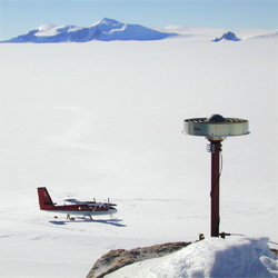
- Antarctica
- Andaman-Nicobar region of the Great 2004 Sumatra-Andaman earthquake
- New Madrid seismic zone
Current CERI investigators are:
